
289.6 km
Wirdum
Wappen Wirdum. Quelle: Wikimedia Commons (Lizenz: Public domain; Urheber: unbekannt)
Das ostfriesische Wirdum ist eine Gemeinde im Landkreis Aurich. Sie ist Teil der Samtgemeinde Brookmerland. Wirdum hat 956 Einwohner.KI-generierte Zusammenfassung Quelle: Wikipedia (Stand: 29.06.2026), Lizenz CC BY-SA 4.0
- Postleitzahl
- 26529
- Vorwahl
- 04920
Heimat- oder Geschichtspfleger:in für Wirdum?
Trag hier die Geschichte deines Ortes ein — Ereignisse, Persönlichkeiten und mehr. Nach einer kurzen Prüfung durch die Redaktion bekommst du die Pflege dieser Seite.
Heimatpflege übernehmenSehenswürdigkeiten
Noch keine erfasst.
Touren (6)
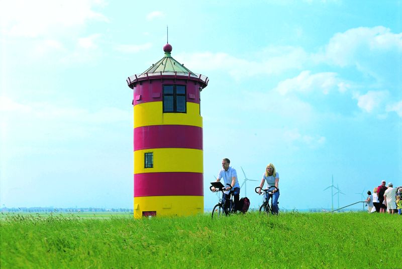
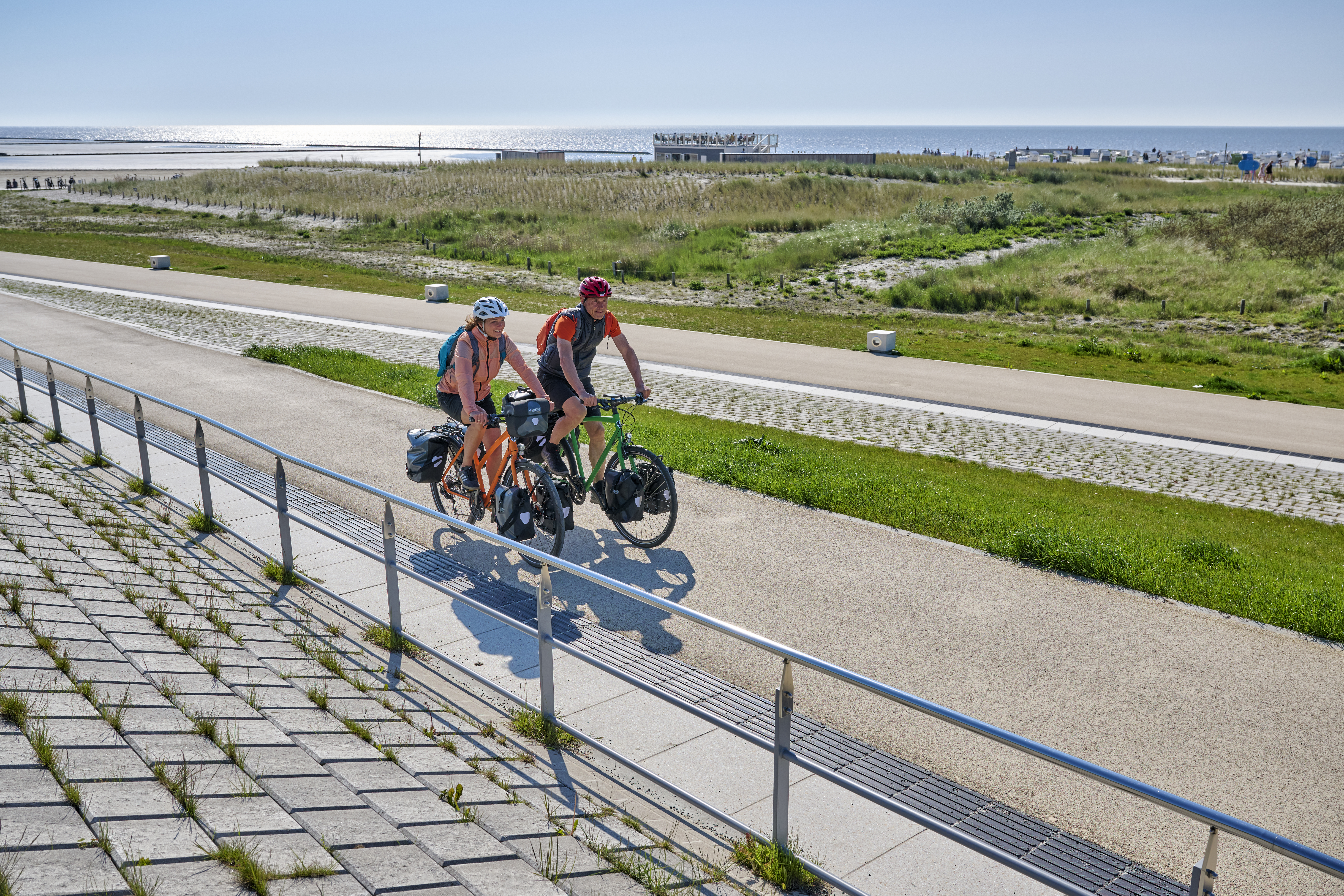
- Friesenroute Rad up Pad · Biken
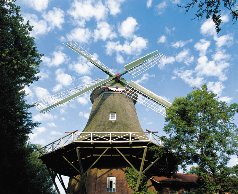
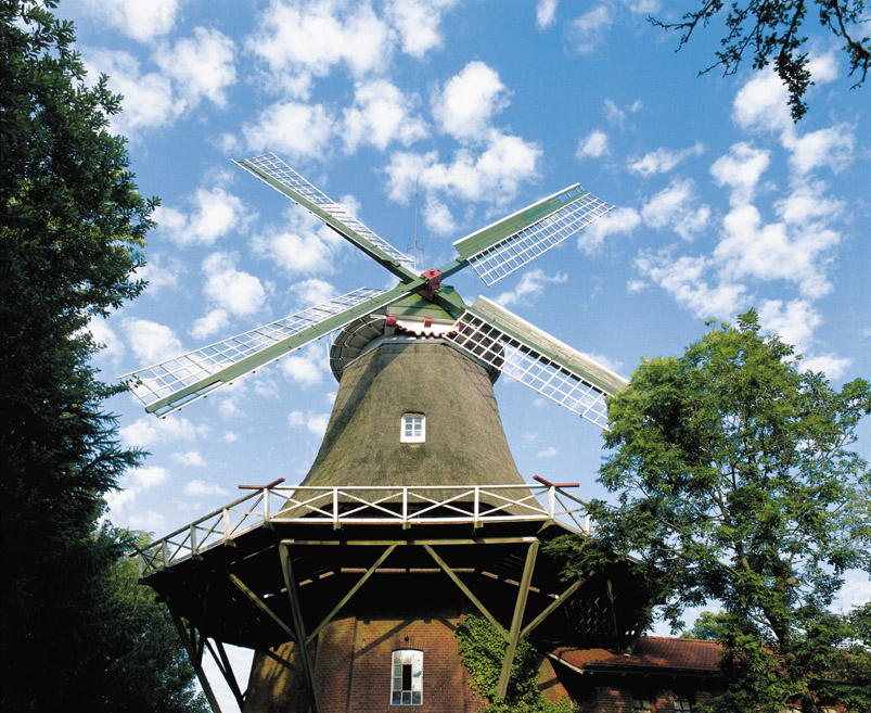
- Friesische Mühlentour · Biken
262.7 km
Persönlichkeiten (1)
Unternehmen vor Ort
Noch keine erfasst.
Alle Betriebe der Region findest du unter Unternehmen. Deiner fehlt? Trag ihn ein — danach kannst du ihn selbst pflegen.
Vereine vor Ort
Noch keine erfasst.
Alle Vereine der Region findest du unter Vereine. Deiner fehlt? Trag ihn ein — danach kannst du ihn selbst pflegen.
Abfallkalender
ÖPNV-Haltestellen (2)
Bushaltestellen (2)
Quelle: GTFS Deutschland (DELFI e.V.)
Flüsse & Gewässer (35)
- Abelitz · Bach · 15.4 km
- Abelitz-Moordorf-Kanal · Kanal · 17.1 km
- Alander Schöpfwerksschloot · Bach · 0.9 km
- Alandschloot · Bach · 1.3 km
- Altes Greetsieler Sieltief · Bach · 16.4 km
- Amerlander Schöpfwerksschloot · Bach · 1.2 km
- Beererschloot · Bach · 0.8 km
- Botterfleth · Bach · 3 km
- Bulleegschloot · Bach · 1 km
- Bunderschloot · Bach · 0.7 km
- Diekenshofschloot · Bach · 1.7 km
- Drennhusenschloot · Bach · 0.9 km
- Durchstich · Bach · 1.8 km
- Friedrichshofschloot · Bach · 1.6 km
- Friedrichswertherschloot · Bach · 1.5 km
- Greedenescherschloot · Bach · 2.2 km
- Grimersumer Neulandschloot · Bach · 1.4 km
- Habelandenschloot · Bach · 1.7 km
- Heerenhofschloot · Bach · 1.3 km
- Kielschloot · Bach · 1.2 km
- Kloster Alander Schöpfwerksschloot · Bach · 1.7 km
- Kloster Alandschloot · Bach · 1.2 km
- Kloster Fennenschloot · Bach · 0.8 km
- Meer Alandschloot · Bach · 2.1 km
- Neulandschloot · Bach · 0.7 km
- Rothe Scheunenschloot · Bach · 1.4 km
- Schoonorther Zugschloot · Bach · 7.6 km
- Störtebeker Tief · Bach · 4.1 km
- Tollenhammschloot · Bach · 2.7 km
- Uppingerschloot · Bach · 2.7 km
- Uttumer Tief · Bach · 5.9 km
- Vordermeedenschloot · Bach · 1.5 km
- Warfenfeldschloot · Bach · 1.1 km
- Wilhelmshofschloot · Bach · 1.2 km
- Wirdumer Tief · Bach · 2.2 km
Quelle: NLWKN-Umweltkartenserver
Statistiken zu Wirdum
Breitband- und Glasfaserausbau
80,2 % der Haushalte mit Glasfaseranschluss (FTTB/H) für mindestens 1.000 Mbit/s
80,2 % Gigabitversorgung insgesamt (alle Technologien, inkl. Kabelnetz)
Quelle: Breitbandatlas der Bundesnetzagentur (Gigabitgrundbuch), Datenstand 12.2025. Nur der aktuelle Stand verfügbar, noch kein Verlauf über mehrere Jahre.
Photovoltaik-Ausbau
121 Photovoltaikanlagen mit insgesamt 1,5 MW installierter Leistung
1,55 kW je Einwohner installiert
+0,2 MW Zubau in den letzten 12 Monaten
Quelle: solarzubau.de auf Basis Marktstammdatenregister (Bundesnetzagentur), Datenstand 2026-08-11, CC-BY 4.0. Nur Gemeinden mit mindestens 50 Anlagen im Quelldatensatz enthalten; nur der aktuelle Stand verfügbar, noch kein Verlauf über mehrere Jahre.
Wind-, Biomasse- und Wasserkraftanlagen
5 Windenergie-Anlagen in Betrieb mit 2,5 MW installierter Leistung
1 Biomasse-Anlagen in Betrieb mit 0,3 MW installierter Leistung
Quelle: open-MaStR (Reiner-Lemoine-Institut) auf Basis Marktstammdatenregister (Bundesnetzagentur), Datenstand 2025-02-09, DL-DE-BY-2.0. Nur der aktuelle Stand verfügbar, noch kein Verlauf über mehrere Jahre.
Bevölkerungsentwicklung
956 Einwohner — Stand 2025, gegenüber 1.057 Einwohner im Jahr 2015.
unter 18 Jahre
166 Einwohner — Stand 2025, gegenüber 213 Einwohner im Jahr 2015.
18 bis unter 65 Jahre
561 Einwohner — Stand 2025, gegenüber 670 Einwohner im Jahr 2015.
65 Jahre und älter
229 Einwohner — Stand 2025, gegenüber 174 Einwohner im Jahr 2015.
Quelle: GENESIS-Online (Regionaldatenbank Deutschland), Tabelle 12411-01-01-5 / 12411-02-03-5, Fortschreibung des Bevölkerungsstandes, Stand 31.12. je Jahr. Altersgruppen aus 17 GENESIS-Gruppen zu drei Buckets zusammengefasst.
Geburten und Sterbefälle
Geburten
7 Geburten — Stand 2024, gegenüber 13 Geburten im Jahr 2015.
Sterbefälle
9 Sterbefälle — Stand 2024, gegenüber 14 Sterbefälle im Jahr 2015.
Quelle: GENESIS-Online (Regionaldatenbank Deutschland), Tabelle 12612-01-01-5 (Statistik der Geburten) / 12613-01-01-5 (Statistik der Sterbefälle), Jahressumme.
Durchschnittsalter
45,4 Jahre — Stand 2025, gegenüber 41,8 Jahre im Jahr 2015.
Quelle: GENESIS-Online (Regionaldatenbank Deutschland), Tabelle 12411-07-01-5, Stand 31.12. je Jahr.
Ausländeranteil
2,6 % — Stand 2025, gegenüber 3,2 % im Jahr 2018.
Quelle: GENESIS-Online (Regionaldatenbank Deutschland), Tabelle 12411-11-01-5, Stand 31.12. je Jahr.
Neubau: Fertiggestellte Wohnungen
9 Wohnungen — Stand 2024, gegenüber 5 Wohnungen im Jahr 2015.
Wohnungsbestand
511 Wohnungen — Stand 2024, gegenüber 513 Wohnungen im Jahr 2015.
Neubauquote
1,8 % — Stand 2024, gegenüber 0,8 % im Jahr 2016.
Quelle: GENESIS-Online (Regionaldatenbank Deutschland), Tabelle 31121-01-02-5 (Baufertigstellungen, Jahressumme) / 31231-02-01-5 (Wohnungsbestand, Stand 31.12.). Neubauquote = fertiggestellte Wohnungen im Verhältnis zum Wohnungsbestand des Vorjahres.
Bodenrichtwerte
28 €/m² Median Wohnbauland (Spanne 25–30 €/m², 2 Zonen)
25 €/m²60 €/m²
Quelle: BORIS-NI (Landesamt für Geoinformation und Landesvermessung Niedersachsen), Gutachterausschüsse für Grundstückswerte. Zonenfarbe relativ zur Preisspanne innerhalb dieser Gemeinde, nicht landesweit vergleichbar. Land-/Forstwirtschaft und Grünflächen (grau) sind wertmäßig nicht mit Bauland vergleichbar und daher separat dargestellt. Kartenausschnitt auf die Bauland-Zonen zugeschnitten, weit entfernte sonstige Flächen können daher am Rand abgeschnitten sein.
Gewerbesteuer und kommunale Finanzkraft
Gewerbesteuer-Hebesatz
400 % — Stand 2024, gegenüber 380 % im Jahr 2016.
Gewerbesteuer netto
98.074 € — Stand 2024, gegenüber 62.299 € im Jahr 2016.
Steuereinnahmekraft
730.282 € — Stand 2024, gegenüber 553.517 € im Jahr 2016.
Quelle: GENESIS-Online (Regionaldatenbank Deutschland), Tabelle 71231-01-03-5, Realsteuervergleich, Jahressumme.
Trinkwasserpreis
Verbrauchsabhängiges Entgelt
1,4 €/m³ — Stand 2024, gegenüber 0,9 €/m³ im Jahr 2015.
Verbrauchsunabhängige Grundgebühr
91,6 €/Jahr — Stand 2024, gegenüber 47,9 €/Jahr im Jahr 2015.
Quelle: GENESIS-Online (Regionaldatenbank Deutschland), Tabelle 32271-01-01-5, Erhebung der Wasser- und Abwasserentgelte, Stichtag 01.01. je Jahr.
Statistiken zum Landkreis Aurich, Landkreis
E-Mobilität
6 % der Pkw mit Elektroantrieb (BEV/Plug-in-Hybrid) — Stand Q3/26, gegenüber 2,9 % zu Beginn Q1/23.
121.071 Personenkraftwagen insgesamt (2024), zum Vergleich.
Quelle: Kraftfahrt-Bundesamt, quartalsweise seit 2023. Pkw-Bestand: GENESIS-Online, Tabelle 46251-02-01-4, Stichtag 01.01.
Arbeitslosenquote
6,5 % — Stand 2025, gegenüber 8,9 % im Jahr 2009.
Quelle: GENESIS-Online (Regionaldatenbank Deutschland), Tabelle 13211-02-05-4, Arbeitsmarktstatistik der Bundesagentur für Arbeit, Jahresdurchschnitt. Bezogen auf alle zivilen Erwerbspersonen.
Hausärztedichte
6,3 je 10.000 EW — Stand 2022, gegenüber 6,2 je 10.000 EW im Jahr 2015.
Quelle: INKAR (Laufende Raumbeobachtung des BBSR); Kassenärztliche Bundesvereinigung.
Krankenhausbetten
548 Betten — Stand 2024, gegenüber 682 Betten im Jahr 2018.
Quelle: GENESIS-Online (Regionaldatenbank Deutschland), Tabelle 23111-01-05-4, Krankenhausstatistik, Stichtag 31.12., Jahresdurchschnitt.
Kinderbetreuung
Betreuungsquote Kinder unter 3 Jahre
31,1 % — Stand 2025, gegenüber 22,2 % im Jahr 2017.
Betreuungsquote Kinder 3 bis unter 6 Jahre
96,4 % — Stand 2025, gegenüber 92,8 % im Jahr 2017.
Quelle: GENESIS-Online (Regionaldatenbank Deutschland), Tabelle 22543-04-01-4, Statistik der Kindertagesbetreuung, Stichtag 1.3. je Jahr.
Schülerinnen und Schüler
19.754 Schüler:innen — Stand 2024, gegenüber 20.329 Schüler:innen im Jahr 2017.
Quelle: GENESIS-Online (Regionaldatenbank Deutschland), Tabelle 21111-01-03-4, Statistik der allgemeinbildenden Schulen, Stichtag Schuljahresbeginn.
Grundstückspreise
Kaufwert Bauland insgesamt
51,5 €/m² — Stand 2025, gegenüber 89,7 €/m² im Jahr 2021.
Kaufwert baureifes Land
111 €/m² — Stand 2025, gegenüber 102,4 €/m² im Jahr 2021.
Quelle: GENESIS-Online (Regionaldatenbank Deutschland), Tabelle 61511-01-03-4, Statistik der Kaufwerte für Bauland, Jahressumme. Statistik seit Berichtsjahr 2021 neu konzipiert, ältere Werte nicht direkt vergleichbar.
Energieverbrauch
261 GWh — Stand 2023, gegenüber 254,5 GWh im Jahr 2013.
Quelle: GENESIS-Online (Regionaldatenbank Deutschland), Tabelle 43531-01-02-4, Jahreserhebung über die Energieverwendung der Betriebe im Verarbeitenden Gewerbe. Aus Tsd. MJ in GWh umgerechnet.
Landwirtschaft
Rinderbestand
105.891 Tiere — Stand 2024, gegenüber 127.630 Tiere im Jahr 2015.
Betriebe mit ökologischem Landbau
50 Betriebe — Stand 2020, gegenüber 37 Betriebe im Jahr 2010.
Ökologisch bewirtschaftete Fläche
3.323 ha — Stand 2020, gegenüber 1.917 ha im Jahr 2010.
Quelle: GENESIS-Online (Regionaldatenbank Deutschland), Tabelle 41312-01-01-4 (Erhebung über die Rinderbestände) / 41141-04-02-4 (Agrarstrukturerhebung / Landwirtschaftszählung, nur Erhebungsjahre 2010/2016/2020).